


MapPad GPS Land Surveys

Beschrijving van MapPad GPS Land Surveys
Gebruik MapPad om gebieden, perimeters en afstanden te berekenen en uw metingen op te slaan, te exporteren of te delen.
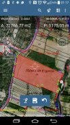
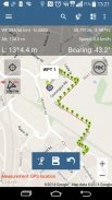
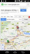
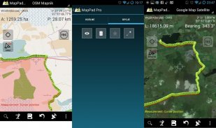
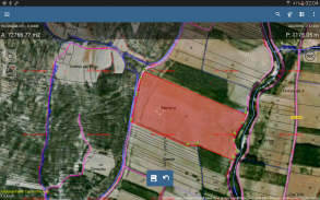
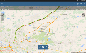
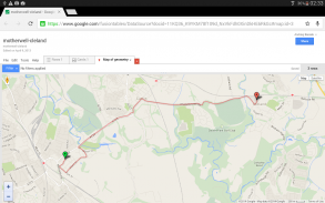
MapPad biedt een multifunctionele kaartoplossing voor het vastleggen van locaties en bepaalt de afstand en het gebied voor de vormen die op de kaart worden getekend of vastgelegd met behulp van realtime GPS-tracking.
Bereken het gebied van het veld of een loopafstand direct met behulp van Google of Bing Map Satellietweergave. Bespaar benzine en tijd en leg functies vast met enkele klikken op de kaart.
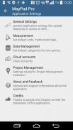
Met MapPad kunt u uw gegevens eenvoudig vastleggen, beheren en delen.
MapPad is een zeer nuttig hulpmiddel voor iedereen die betrokken is bij bosbouw, landbouw, engineering en onroerend goedbeheer.
Bezoek onze website voor meer informatie over het voorbereiden van offline kaarten en voor meer informatie over dit product.
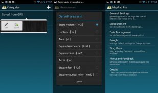
Geselecteerde functies:
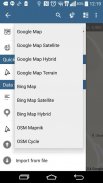
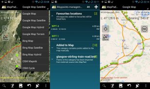
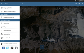
- Basiskaarten: Google Maps, Open Street Map, Bing Maps
- Google Maps-overlays (Custom WMS of ArcGIS Server Tiled-service), sommige lagen zoals de Amerikaanse topografische kaart zijn vooraf gedefinieerd.
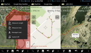
- Zeer nauwkeurige meting van gebieden en afstanden.
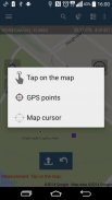
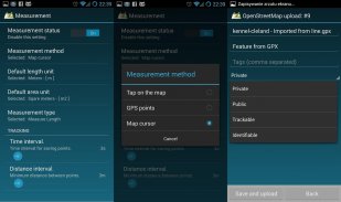
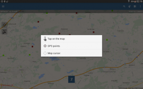
- Er worden 3 meetmethoden ondersteund (tik op de kaart, GPS-locatie, locatie van de kaartcursor).
- Ondersteuning voor aantal metrische en imperiale eenheden.
- Ondersteuning voor verschillende wereldwijde en lokale coördinatensystemen, als u ondersteuning nodig hebt voor andere ruimtelijke referentie, neem dan contact op.
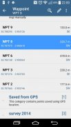
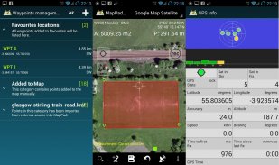
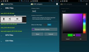
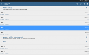
- Mogelijkheid om waypoints vast te leggen en in categorieën te groeperen.
- Mogelijkheid om titel en beschrijving toe te voegen of te bewerken voor elke geregistreerde meting en waypoint.
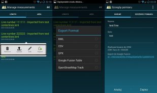
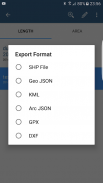
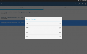
- Exporteer enkele of meerdere metingen of waypoints naar SHP-bestand, Geojson, ArcGIS Json, KML, GPX, CSV en DXF naar SD-kaart of cloudservices las ook als directe export naar Open Street Map.
- Deel één waypoint-locatie rechtstreeks via sms, e-mail of andere manieren.
- Hoogteprofiel beschikbaar voor metingen met GPS.
- Import van KML- en GPX-bestanden naar de applicatie.
- GPS-status en satellietenstatus.
- Adres, locatie zoeken.
- Snel geëxporteerde KML-bestanden in Google Earth
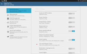
- Mogelijkheid om standaardmeeteenheden, kleuren van waypoints-categorieën, opnametijd en afstandsinterval, transparantie van Google Maps-overlays in te stellen en nog veel meer ...
Onze gebruikers gebruiken MapPad met succes in een aantal projecten en applicaties.
MapPad GPS Land Surveys - versie 7.5.0
(19-05-2019)
MapPad GPS Land Surveys - APK-informatie
APK-versie: 7.5.0Pakket: com.osedok.mappadNieuwste versie van MapPad GPS Land Surveys
Andere versies


Apps in dezelfde categorie
Mogelijk vind je dit ook leuk...
 4.074.44.413.434.04


